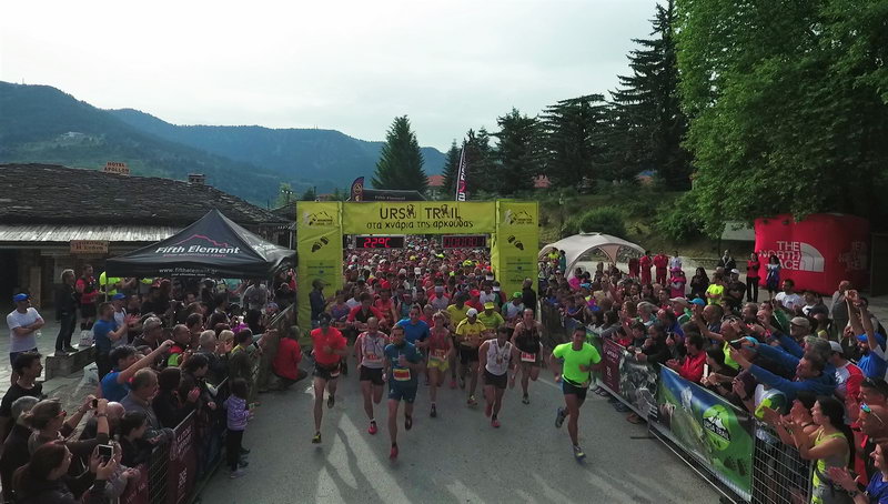
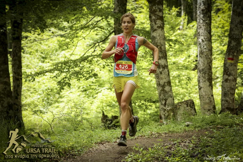
The start of the race takes place in the central square of Metsovo at an altitude of 1150m, in front of the bear statue.
The route follows a wide cobbled road (Averoff street) to the park of Aghios Georgios. From the park, the route goes down a cobbled path, turns right at the fork and arrives in an asphalt road.
Soon we reach the point of separation of the two races (Ursa Trail and The Footsteps of the Bear). For the Footsteps of the Bear we go straight and after 300m we find the 23rd km of Ursa Trail route which we follow to the north).
Always on asphalt, we pass beside the monastery Kimisis tis Thetokou and reaches the road bridge of the Metsovitikos river. We leave immediately the road entering a wide path.
The path goes smoothly uphill crossing a stream twice. After 500 meters we enter a bad dirt road for 400 meters and then a steep path that climbs straight on the the right side of the stream to the very large meadow la Vrise ("the sources"). We leave smaller paths on our left and then reach a dirt road that we follow uphill, passing a fountain with drinking water. At the intersection, we continue right on a dirt road closed by an earth barrier and get closer to the Grand Forest hotel.
Shortly before reaching the hotel, we leave the dirt road and take a slightly downhill path crossing meadows with black pines until we reach the position Gkantelou, where we find a stream. The path descends beside the stream and after 500 meters it becomes a small road that leads to the asphalt road. We then cross the Egnatia highway junction over the tunnel and reach the 1st checkpoint of the race, at 8.2km from the start and an altitude of 1100m.
The trail initially widens, then narrows and then climbs steeply up to a large meadow (position Koukourou). We continue on a small road that soon becomes a path. From here begins the longest continuous climb of the race, from 1100m To 1887m, a climb of 790m in 4km. We pass right of a pointy rock (position Papankola) and continue on a steep slope to the plateau - parking where the chalet is located, as well as the chapel of Profitis Ilias and the second checkpoint of the race at 11km from the start and an altitude of 1660m.
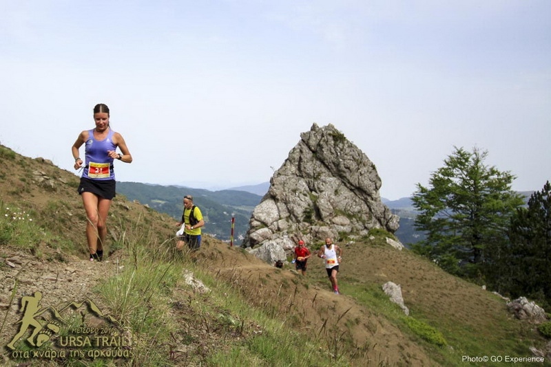
From the Anilio Ski Center chalet we take a downhill dirt road to the base 3 the lifts. We then take a path that intersects a gravel road and climbs steeply to the summit Dokimi (1871m). From the top we see all the peaks and valleys of Central and Northern Pindos, from Smolikas to Tzoumerka.
From the top, the route takes a very steep path for about 500 m. in beech woodland and continues more smoothly in meadows and on a ridge with beautiful views. We then head northwest and reach a large meadow and source (position La Livatze). From there, we continue on a wide path that soon becomes a dirt track. We then leave two dirt tracks to the left and continue until a crossraod on Largi col, where we find the third checkpoint, at 15km from the start and an altitude of 1500m.
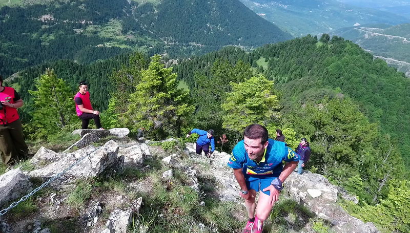
The race route goes straight on bad dirt road and passes through Tafili, on the southern slopes of the peak Fatzeto, and reaches the large col Tzan la Vale Mare. From there, a steep ridge with broken rocks and some chains and ladders leads us to the fire lookout station of Fatzeto summit (1634 m).
From Fatzeto we continue downhill in beech forest towards Anilio on a steep path until the position Skamni. There we head southwest and the path becomes less steep. We pass under a small drainage basin with a trough, then enter a wider path and reach a large fountain located a few meters above the dirt road. We follow the dirt road (below us is a tunnel of Egnatia Odos) and continue until the asphalt road. We follow it a few meters to the right before descending into the village on a cement road. We cross Anilio on small streets until we get to the big parish church of Aghia Paraskevi on the edge of the village, which is the 4th checkpoint, at about 22km from the start and at an altitude of 1000 m
From the churchyard the route continues into a dirt path that leads to the asphalt path. We cross a large bridge on the Metsovitiko River, in front of an artificial waterfall. This is the lowest point of the route at 920m, after a 700-meter descent in 3.5km.
We follow the asphalt road for a while and get to the entrance of vines below the monastery of Aghios Nikolaos. We climb the nice cobbled path, we pass the entrance of the monastery and continue until the cement road, leaving a narrow road and a cemetery on our right. On the cement road we go left until we meet the main asphalt road and head west. From the position Grizios, we take a narrow uphill asphalt street that passes through the old Tositsa institution's premises, where only a carpenter workshop still operates. We exit the site and go left at the asphalt road, cross the national road and reach the War Memorial, where the route enters a path.
This part of the route until "Politsoara" meadow has been decorated with works of the Athens School of Fine Arts, starting with the gateway where the path starts. The path crosses a small grove and soon reaches a sightseeing spot with seats made of tree trunks. The trail then climbs on a ridge (on our left we distinguish trenches of the Civil War) and reaches a resting point. From there we continue to the top of the lift of Metsovo ski resort near Karakoli summit.
From Karakioli we descend to the meadows of Politsoara, the 5th checkpoint at 27.5km from the start and at an altitude of 1415m.
From Politsoara we follow a wide path that soon passes by Daou fountain (trough) and becomes a wider track. We then arrive at a crossroad and continue left on level terrain for about 1500 meters and then climb a path to the highest point of the ridge called "Kalligomeno Aloni" (1593 m), where we see a wind measuring mast on our left. We continue with slight descents and climbs on the ridge (we see trenches of WW2 on our left), pass a stone resting place with nice views and reach a col, where we turn right and begin to descend next to a stream. After 700 meters we enter a dirt road and soon reach a junction near the old wooden camp buildings of Vale Di Liosani, the 6th checkpoint at 33.5km from the start and at an altitude of 1400m.
We then take the right dirt road, pass a wooden bridge and climb gradually passing two other wooden bridges. After a relatively steep climb, the road descends and stops: we enter a path that intersects an asphalt road, slightly higher than the large fountain of Kria Vrisi. The path continues opposite, climbs up to a col, then descents tucked into woods and comes out again in the meadows. On street and path we reach the fountain Politsoara (two ponds) where we find the 7th checkpoint at the 37th km and an altitude of 1400 m.
We continue on a dirt road for 100m and catch an uphill path that soon becomes a wider track and leads us near the summit Karakioli. From there we start a long descent to the base of the ski lift, following the ski piste (labeled "Difficult Route"). Arriving at the height of the cafe-teleferique, we cross the asphalt and enter a path. At 200 meters we enter a cement road that passes in front of the Pindos National Park Information Center. From there we descend first on cement road and next on wide cobbled path until we get to the central square of Metsovo. We go around the square before finishing.